All images / illustration
Indian ocean region detailed editable map
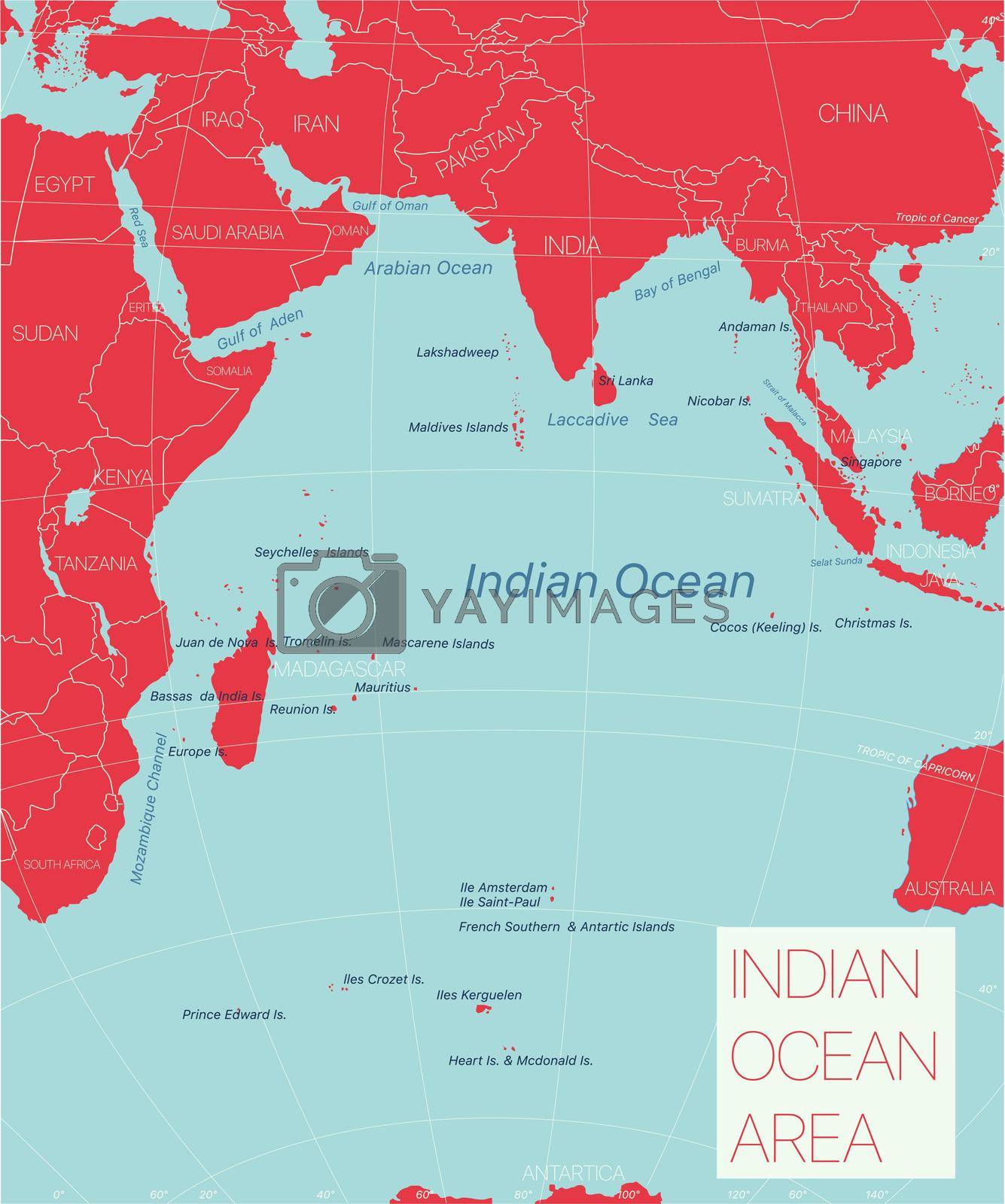
Indian ocean region detailed editable map with regions cities and towns, geographic sites. Vector EPS-10 file
-
License:
Royalty Free License.
The license type determines how you can use this image.

Std. Ext. Print / Editorial Graphic Design Web Design Social Media Edit & Modify Resale Items 1 Unlimited Runs - Please see licensing information by clicking here
Vector
All images / illustration
Size Selection:
You can re-download any size after the purchase.
Want to Download? Subscribe and
Gain Access to Millions of Stock Assets:
Keywords
-
geography
illustration
map
country
atlas
africa
island
cartography
egypt
seychelles
zambia
peninsula
vector
reunion
border
indian
kenya
ocean
congo
tanzania
madagascar
maldives
political
uganda
asia
sea
state
earth
continent
south
indian ocean
administrative
indonesia
antarctica
australia
arabian
mapping
bengal
global
southern
destination
zimbabwe
sri lanka
bay
labeling
southern ocean
navigation
education
water
political map